Sorry, due to changes in how the API and search features of Twitter work, the Twitter Weather Map is not working anymore.
For now, I didn’t have the time and resources to update the code. In the meantime, have a look at some of my other projects, like Geosketches or Rhizome Navigation.
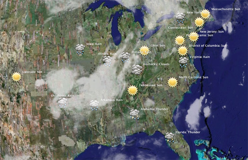
Below is a screenshot of the Twitter Weather Map for the United States combined with a Cloud Layer in Google Earth.
How does it work?
Talking about the weather — you often do that to just keep a conversation going. People do the same on twitter (among other things) and the map above tries to give you a picture of the weather by tracking these conversations.
This is just a simple example to illustrate the hidden power and possible emergence that lies within social media, presence services and livestreams.
This is a quick hack inspired by metaroll.de. Using summize I fetch messages from twitter which contain words about the weather in various locations. A simple algorithm measures what people are talking about and renders a KML file which gets displayed above. The file gets updated every hour. Have a look at wetter.orf.at for a comparison with actual meteo data.
June 2008 - Done in three hours by Walter Rafelsberger
Weather icons from nordicweather.com
Feedback
- ”Simply Genius” Google Maps Mania
- ”Einfach super!” wissenbelastet.com